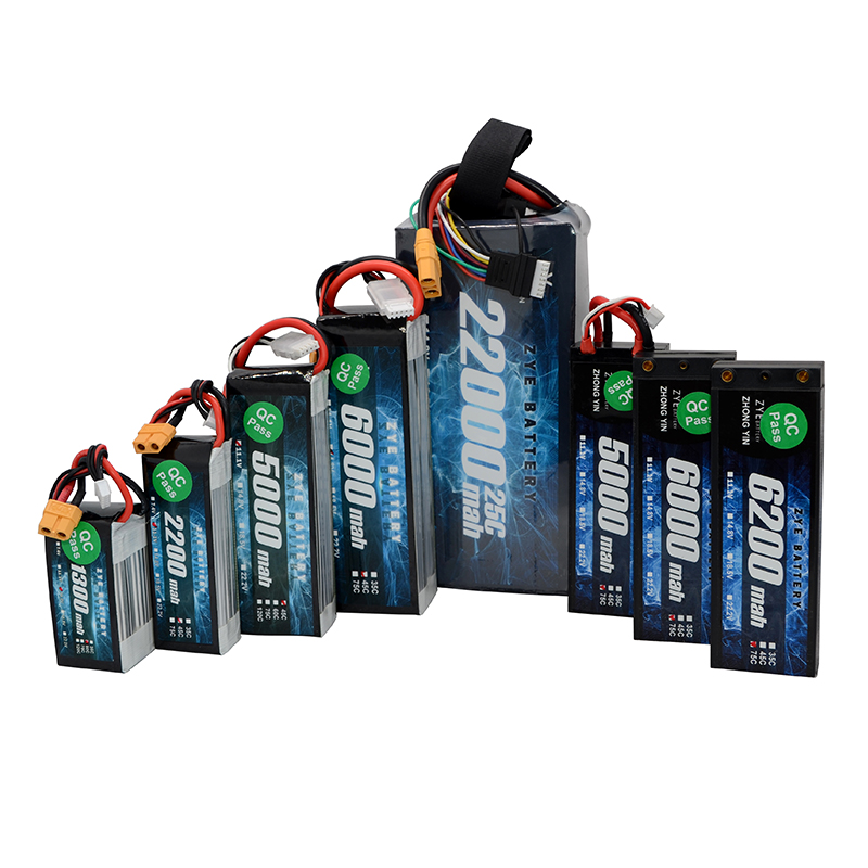
Long-Range Drone Batteries for Surveying & Mapping
2025-05-27
The world of surveying and mapping has been revolutionized by the advent of drone technology. These unmanned aerial vehicles have become indispensable tools for professionals in the field, offering unparalleled efficiency and accuracy. However, the effectiveness of these drones heavily relies on one crucial component: the battery. In this comprehensive guide, we'll explore the intricacies of long-range drone battery technology for surveying and mapping applications, helping you make informed decisions for your next project.
What battery features are crucial for mapping drones?
When it comes to selecting the ideal drone battery for mapping and surveying tasks, several key features stand out as paramount. Let's delve into these essential characteristics that can make or break your drone's performance in the field.
High capacity and energy density
The battery’s capacity is a foundational element for any long-range drone operation. Surveying and mapping tasks often require extended flight times to cover large areas, and a high-capacity battery ensures that the drone can stay airborne for the duration needed. Energy density is another vital factor, as it determines the amount of energy the battery can store relative to its weight. A battery with high energy density allows for longer flight times while maintaining a lightweight design, which is essential for ensuring the drone’s agility and operational efficiency. This balance between energy storage and weight is critical for maximizing performance without compromising on speed or maneuverability.
Durability and temperature resistance
Mapping drones often operate in harsh environments, where temperatures can vary greatly. Whether in the heat of a desert or the cold of a mountain range, the drone battery must be durable enough to withstand these extreme conditions without degrading in performance. Temperature resistance becomes particularly important, as battery efficiency can drop dramatically in extreme temperatures. A battery designed to function optimally across a wide range of temperatures ensures reliable operation in all conditions, making it a key factor in ensuring the success of field surveys in diverse climates.
Fast charging capabilities
In the fast-paced world of mapping and surveying, time is critical, and minimizing downtime between flights is essential. Batteries with fast-charging capabilities allow for quicker turnaround times between flights, increasing the overall operational efficiency. This feature becomes especially valuable for large-scale projects, where multiple drone flights are required to cover a significant area. The ability to quickly recharge the battery means that the drone can remain in constant operation, thus maximizing productivity and reducing idle time during extended mapping sessions. Fast-charging batteries enable surveyors to complete projects more efficiently, making them a must-have for time-sensitive tasks.
High-efficiency batteries for beyond-visual-line-of-sight flights
Beyond-visual-line-of-sight (BVLOS) flights represent the cutting edge of drone surveying and mapping. These operations push the boundaries of what's possible with drone technology, allowing for the mapping of vast, remote areas. However, BVLOS flights also place unprecedented demands on drone batteries.
Advanced battery management systems
For BVLOS operations, advanced battery management systems (BMS) are non-negotiable. These sophisticated systems monitor and optimize battery performance in real-time, ensuring safe and efficient operation even when the drone is miles away from the operator. A state-of-the-art BMS can provide accurate estimates of remaining flight time, optimize power distribution, and even predict potential issues before they occur.
Lightweight yet powerful solutions
The delicate balance between weight and power becomes even more critical in BVLOS flights. Lightweight batteries that don't compromise on power output are essential for maximizing range while maintaining the drone's payload capacity for sensors and mapping equipment. Innovations in battery chemistry, such as lithium-sulfur and solid-state technologies, are paving the way for batteries that offer unprecedented energy density and weight savings.
Redundancy and fail-safe features
When operating beyond visual line of sight, safety becomes paramount. Batteries equipped with redundancy features and fail-safe mechanisms provide an extra layer of security. These could include backup power sources, intelligent power distribution systems, and emergency landing protocols triggered by critical battery levels.

How surveyors optimize battery use for maximum coverage
Efficient battery utilization is a skill that separates novice drone operators from seasoned surveying professionals. By employing smart strategies and leveraging advanced technologies, surveyors can significantly extend their coverage area without compromising data quality.
Strategic flight planning
Meticulous flight planning is the foundation of efficient battery use. Surveyors use sophisticated software to plot optimal flight paths that minimize energy consumption while ensuring complete coverage of the target area. Factors such as terrain, wind patterns, and obstacles are all taken into account to create energy-efficient flight plans.
Adaptive power management
Modern mapping drones are equipped with adaptive power management systems that adjust power consumption based on real-time conditions. These systems can modulate motor output, sensor activity, and even data transmission rates to conserve energy when possible, extending flight times without sacrificing data quality.
Multi-battery strategies
For large-scale projects, surveyors often employ multi-battery strategies. This approach involves strategically planning battery swaps to maintain continuous operation. Some advanced drones even feature hot-swappable batteries, allowing for seamless transitions between power sources without powering down the entire system.
In conclusion, the selection and optimization of drone battery technology play a pivotal role in the success of surveying and mapping projects. As drone technology continues to evolve, so too do the possibilities for more efficient, longer-range, and safer operations. By staying informed about the latest advancements in battery technology and employing smart utilization strategies, surveyors and mappers can push the boundaries of what's possible in aerial data collection.
Are you looking to elevate your surveying and mapping capabilities with cutting-edge drone battery technology? Look no further than Ebattery. Our state-of-the-art batteries are designed to meet the demanding requirements of professional drone operators, offering unparalleled performance, reliability, and efficiency. Don't let battery limitations hold your projects back. Contact us today at cathy@zyepower.com to discover how our advanced battery solutions can transform your surveying and mapping operations.
References
1. Smith, J. (2023). "Advancements in Drone Battery Technology for Surveying Applications." Journal of Unmanned Aerial Systems, 15(2), 78-92.
2. Johnson, A. & Lee, S. (2022). "Optimizing Battery Performance in Long-Range Mapping Drones." International Conference on Drone Surveying and Mapping, Conference Proceedings, 112-125.
3. Brown, R. (2023). "Beyond Visual Line of Sight: Battery Challenges and Solutions." Drone Technology Review, 8(4), 201-215.
4. Zhang, L. et al. (2022). "Energy-Efficient Flight Planning for Large-Scale Aerial Mapping." IEEE Transactions on Geoscience and Remote Sensing, 60(7), 1-14.
5. Davis, M. (2023). "The Future of Drone Batteries: Innovations in Materials and Design." Advanced Energy Materials, 13(5), 2200184.


